
Southern Vietnam offers varied landscapes for those interested in outdoor walking experiences, ranging from challenging mountain ascents to tranquil national park trails. This region provides numerous opportunities for trekkers to explore diverse terrain and natural beauty, making it an appealing destination for active travelers.
Overview of Southern Vietnam's Trekking Landscape
The southern part of Vietnam features a collection of mountains and national parks that cater to different levels of trekking experience. While not as rugged as some northern ranges, these areas provide accessible options for day trips or multi-day excursions, often within a reasonable distance from major urban centers like Ho Chi Minh City.
The terrain typically includes a mix of forested slopes, open plains, and agricultural lands, providing varied scenery throughout a trek. Understanding the local geography and climate is key to planning a successful outdoor adventure in this part of the country. For general insights into travel conditions across the country, consider reviewing information on Vietnam travel seasons.
Notable Trekking Destinations in Southern Vietnam
Southern Vietnam hosts several distinct locations for trekking, each with its own characteristics and appeals. These sites range from prominent peaks offering extensive views to national parks preserving unique ecosystems.
Black Virgin Mountain (Nui Ba Den), Tay Ninh Province
Known as the highest peak in Southeastern Vietnam, Black Virgin Mountain reaches an elevation of 986 meters. It is situated approximately 11 kilometers northeast of Tay Ninh Province. From a distance, the mountain appears as a distinct conical shape rising from the expansive plains. As one ascends, the air becomes noticeably cooler, and the views broaden to encompass the surrounding countryside.
This mountain is a popular destination for both local visitors and those from further afield who appreciate hiking. The trails offer a chance to engage with nature and experience the regional topography.
Nui Chua National Park, Ninh Thuan Province
Nui Chua National Park is located in Ninh Hai District, Ninh Thuan Province. It is bordered by the South China Sea to its east and south, with Cam Ranh Bay to the north. National Route 1A also runs nearby. A trek within the park, such as the route from Da Hang Village to O Liem Spring, reveals terraced rice fields cultivated by the Raglai community.
Along the paths, visitors can observe natural springs, unique rock formations, herds of grazing goats, and a variety of plant species, creating a sense of being in a distinct natural environment.
Chua Chan Mountain, Dong Nai Province
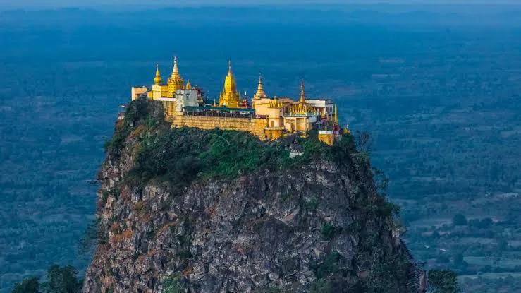
Rising to an altitude of 800 meters above sea level, Chua Chan Mountain is found in Xuan Loc District, Dong Nai Province, about 110 kilometers from Ho Chi Minh City. The mountain is recognized for its prominent scenery, particularly Buu Quang Pagoda, which is located at its summit. This pagoda is considered the largest and highest religious structure in the immediate vicinity.
The journey to the top involves ascending approximately 400 steps, offering both a physical challenge and access to the pagoda's elevated position.
Ta Cu Mountain, Binh Thuan Province
Ta Cu Mountain stands at 649 meters above sea level and is positioned alongside National Route 1A, roughly 28 kilometers from Phan Thiet City. This mountain provides an accessible trekking experience for those seeking a moderate climb. The trail to the summit extends for approximately 2,290 meters and includes various gradients.
Completing the ascent typically takes around two hours, rewarding trekkers with views from the peak.
Cam Mountain, An Giang Province
Cam Mountain is part of the That Son Mountain range in An Giang Province, an area known for its cooler climate and appealing scenery. The mountain's reputation for being intriguing is partly due to its winding and demanding trails, which present a challenge to those aiming to reach the summit. Starting a trek early in the morning can offer views of white clouds gently moving above extensive rice fields. For more on the natural attractions in this region, explore the Tra Su Cajuput Forest in An Giang.
Bidoup Mountain, Lam Dong Province
Bidoup is identified as the highest mountain within Bidoup National Park, located in Lac Duong District, approximately 50 kilometers from Da Lat City. The route leading to Bidoup’s summit showcases a diverse natural environment, featuring extensive pine forests, cascading waterfalls, and a wide array of plant species.
The journey through these varied landscapes offers a rewarding experience for nature enthusiasts.
Ba Ra Mountain, Binh Phuoc Province
The peak of Ba Ra Mountain reaches an altitude of 723 meters and is situated in Phuoc Long District, Binh Phuoc Province. The area is characterized by a calm atmosphere and pleasant natural settings. To access the trekking trail, travelers from Dong Xoai District should follow Provincial Route 741, passing through Phuoc Long District until reaching the Ba Ra Cable Car Station. From there, a walk of approximately 500 meters leads to the start of the mountain trail. The trek itself allows for observation of surrounding scenes, including Thac Mo Lake and groupings of green bamboo.
Langbiang Mountain, Lam Dong Province
Langbiang Mountain is located in Lac Duong District, about 12 kilometers north of Da Lat City, and stands at an elevation of 2,000 meters. As the second highest mountain within Bidoup National Park, its summit offers expansive views over the charming city of Da Lat below. Reaching this peak often evokes a sensation of being in an otherworldly setting.
For an extended exploration of Vietnam's diverse regions, including both its northern karsts and southern deltas, a grand traverse across Vietnam might be an ideal option.
Preparing for Your Trek
Proper preparation is crucial for any trekking excursion in Southern Vietnam. Essential items include appropriate footwear, sufficient water, sun protection, and a basic first-aid kit. While many trails are well-marked, carrying a map or GPS device is advisable, especially for less frequented routes. It is also wise to inform someone of your trekking plans and expected return time.
Considering the tropical climate, lightweight, breathable clothing is recommended. For those planning to use local transportation to reach trailheads, understanding how to navigate services like taxis in Vietnam can be helpful for a smoother journey.
Best Times to Visit for Trekking
The dry season, generally from November to April, is often considered the most favorable period for trekking in Southern Vietnam. During these months, rainfall is minimal, and temperatures are typically more moderate, making trail conditions more agreeable. The rainy season, from May to October, can bring heavy downpours that make trails slippery and challenging, and may also increase the presence of insects.
However, even during the dry season, it is advisable to start treks early in the morning to avoid the midday heat. For those interested in trekking during cooler months, information on winter trekking routes in Vietnam might offer additional context, although southern regions experience less pronounced winter conditions.
Summary of Southern Vietnam Trekking Locations
| Mountain/Park | Province | Altitude (approx.) | Key Features |
|---|---|---|---|
| Black Virgin Mountain | Tay Ninh | 986 m | Highest in SE Vietnam, conical shape, panoramic views |
| Nui Chua National Park | Ninh Thuan | Varies | Coastal park, terraced fields, diverse flora/fauna |
| Chua Chan Mountain | Dong Nai | 800 m | Buu Quang Pagoda at summit, 400 steps |
| Ta Cu Mountain | Binh Thuan | 649 m | 2,290m trail, 2 hours to summit |
| Cam Mountain | An Giang | Varies | Winding trails, cool weather, morning cloud views |
| Bidoup Mountain | Lam Dong | Varies (highest in park) | Pine forests, waterfalls, diverse plant species |
| Ba Ra Mountain | Binh Phuoc | 723 m | Calm atmosphere, Thac Mo Lake, bamboo groves |
| Langbiang Mountain | Lam Dong | 2,000 m | Second highest in Bidoup NP, views of Da Lat |
For those interested in a broader exploration that includes these southern areas and extends north, consider a comprehensive Southern to Northern Vietnam journey.
Frequently Asked Questions
What is the highest mountain in Southern Vietnam?
Black Virgin Mountain, also known as Nui Ba Den, holds the distinction of being the highest mountain in Southeastern Vietnam, with an elevation of 986 meters.
Are guides necessary for trekking in Southern Vietnam?
For well-established and popular trails like those on Black Virgin Mountain or Ta Cu Mountain, a guide may not be strictly necessary for experienced trekkers. However, for exploring more remote areas within national parks or for those unfamiliar with the local language and terrain, hiring a local guide is highly recommended for safety and to enhance the experience.
What should I pack for a day trek in Southern Vietnam?
For a day trek, essential items include at least 2-3 liters of water, high-energy snacks, sun protection (hat, sunscreen, sunglasses), insect repellent, a lightweight rain jacket, a small first-aid kit, and a fully charged phone. Comfortable, worn-in hiking shoes are also crucial. It's advisable to carry a small backpack to keep your hands free.