Gia Lai Province, located in Vietnam's Central Highlands, presents a distinctive destination for travelers seeking natural landscapes and cultural insights. As the second-largest province in the country, it encompasses a varied terrain and is home to multiple ethnic communities, contributing to a rich local heritage. This guide offers an overview of Gia Lai's characteristics, including its geographical setting, climate patterns, significant points of interest, and available transport options for visitors.
Geographical and Climatic Overview of Gia Lai
Gia Lai is a mountainous province positioned in the northern part of the Tay Nguyen region of Vietnam. Its elevation averages between 700 and 800 meters above sea level, contributing to its varied topography and scenic vistas. The province shares its eastern boundary with Quang Ngai, Binh Dinh, and Phu Yen provinces. To the west, it borders Ratanakiri Province in Cambodia, a frontier extending approximately 90 kilometers. Dak Lak province lies to its south, while Kon Tum province is situated to its north.
The climate in Gia Lai is characterized as tropical monsoon, featuring ample humidity and substantial rainfall. The region experiences two distinct seasons: a wet season and a dry season. Notably, it typically avoids tropical storms and experiences hoarfrost. Rainfall distribution varies across the province; the Eastern Truong Son region receives an annual average of 1,200 to 1,750 mm, whereas the Western Truong Son area records higher precipitation, averaging 2,200 to 2,500 mm annually. These climatic conditions, combined with the fertile soil, support the cultivation of various industrial crops, livestock farming, and agroforestry, which are vital to the local economy.
Historical Background and Cultural Identity
Historically, Gia Lai province was inhabited by indigenous groups such as the Jrai, Ba nah, and Cham Hroi peoples, who traditionally lived in distinct villages. Before the period of French colonial administration in the Central Highlands, these ethnic communities were transitioning from primitive societal structures to more stratified systems. The administrative boundaries of the region underwent several changes, leading to the establishment of Pleiku Province on May 24, 1932, under the authority of the Governor-general of Indochina. Following 1975, Pleiku province was officially renamed Gia Lai province.
Today, Gia Lai is a melting pot of various ethnic minorities, including the Kinh, Jrai, Ba Nah, Tay, Nung, Muong, Thai, and Dao. This demographic diversity results in a province rich in cultural expressions, traditional customs, and religious practices. Visitors can observe unique architectural styles and local traditions preserved within the villages, offering a glimpse into the region's deep-rooted heritage. The province's cultural richness also extends to its local products and traditional crafts, which reflect the skills and artistry of its diverse communities. For those interested in acquiring unique purchases from a trip to Vietnam, exploring these local offerings can be a rewarding experience.
Exploring Gia Lai's Natural and Cultural Attractions
Gia Lai is renowned for its array of natural landscapes and cultural sites, offering a variety of experiences for visitors. The province features extensive tropical forests, impressive waterfalls, serene lakes, and unique geological formations. These natural settings provide opportunities for outdoor activities and appreciating the region's biodiversity.
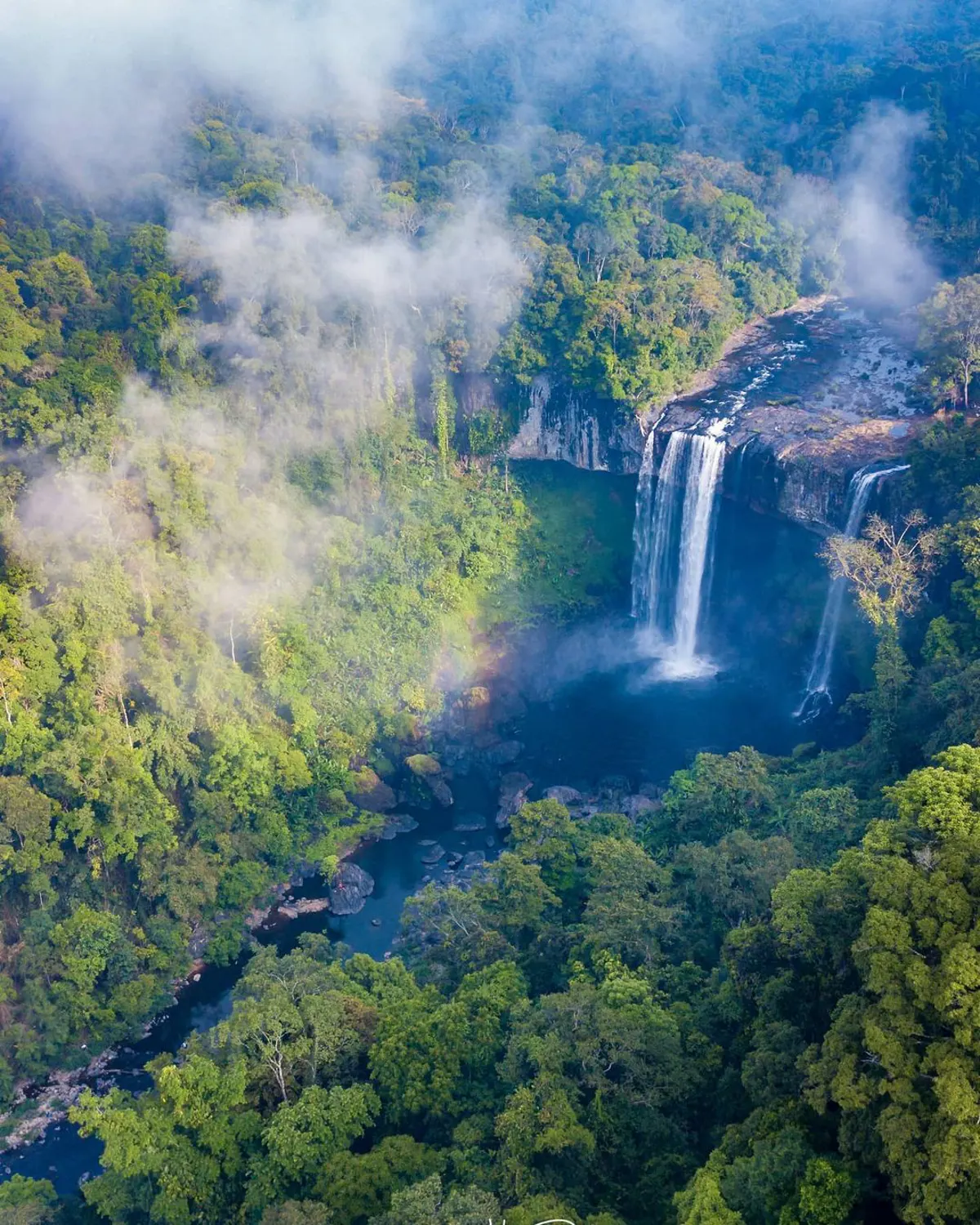
Among the notable natural features are the Kon Ka Kinh and Kon Cha Rang tropical forests, which are significant for their ecological value. Waterfalls like Phu Cuong Waterfall, Xung Khoeng Waterfall, and the multi-tiered Nine-tiered waterfall showcase the area's hydrological beauty. K50 Waterfall, also known as Hang En Waterfall, is situated within the Kon Chu Rang Nature Reserve in Son Lang Commune, Kbang District, and is celebrated for its remote beauty. Other natural highlights include Mo springs, Da Trang, and Ayaun Ha Lake. Bien Ho, a lake formed within an extinct volcano, is particularly known for its clear waters.
Beyond its natural wonders, Gia Lai also offers cultural points of interest. Dong Xanh Cultural Park displays various flowers typical of the Tay Nguyen region. The provincial capital, Pleiku City, and its surrounding areas host several sites reflecting local history and community life. While specific operational details such as addresses, phone numbers, opening hours, or entry fees for these locations were not provided in the source material, visitors typically find current information through local tourism offices or by inquiring upon arrival.
Key Attractions in Gia Lai Province
- Lake T'Nung
- Dai Doan Ket Square
- Phu Cuong Waterfall
- Ho Troi in Gia Lai
- Lake of Tea
- Chu Dang Ya Volcano
- Thac Ba Lake
- Chong Khong Waterfall
- Nine-tiered waterfall
- Kon Jang Rang Nature Reserve
- Kon Ka Kinh National Park
- Minh Thanh Pagoda
- Pleiku Prison Historic Site
Transportation Options for Reaching Gia Lai
Accessing Gia Lai province is facilitated by both road and air networks, making it relatively convenient for travelers. The province is connected to major economic and political centers of Vietnam through key transportation arteries.
National Road No. 14 serves as a crucial link, connecting Gia Lai with Dak Lak and Kon Tum provinces, and extending further to destinations like Da Nang and Ho Chi Minh City. Additionally, the Ho Chi Minh route has significantly reduced travel distances between Gia Lai and other important national hubs. For those preferring air travel, Pleiku Airport (PXU) provides domestic flights, connecting the province to cities such as Hanoi and Ho Chi Minh City, offering a faster alternative to ground transportation.
Frequently Asked Questions
Where is Gia Lai Province located?
Gia Lai Province is situated in the Central Highlands region of Vietnam, specifically in the northern part of Tay Nguyen, approximately 700-800 meters above sea level.
What are the primary ethnic groups residing in Gia Lai?
Gia Lai is home to a diverse population including the Kinh, Jrai, Ba Nah, Tay, Nung, Muong, Thai, and Dao ethnic minorities, contributing to its rich cultural landscape.
What is the typical climate in Gia Lai?
The province experiences a tropical monsoon climate with distinct wet and dry seasons, abundant humidity, and significant rainfall, though it is generally free from tropical storms.
How can travelers reach Gia Lai?
Travelers can reach Gia Lai by road via National Road No. 14 and the Ho Chi Minh route, which connect it to other major provinces and cities. Air travel is also an option, with flights arriving at Pleiku Airport (PXU).
What are some notable natural attractions in Gia Lai?
Key natural attractions include K50 Waterfall (Hang En Waterfall) in Kon Chu Rang Nature Reserve, Phu Cuong Waterfall, Bien Ho (a lake in an extinct volcano), Kon Ka Kinh National Park, and Ayaun Ha Lake.