Ma Pi Leng Pass, located within Vietnam's Ha Giang Province, stands as a significant mountain route known for its demanding curves and sheer rock faces. For those who reach its summit, the effort is often rewarded with extensive views, featuring clouds moving through the air, grand green mountains, and the calm, turquoise waters of the Nho Que River below. It offers a profound experience for individuals who appreciate natural landscapes and seek adventure.
Understanding Ma Pi Leng Pass
Ma Pi Leng Pass, approximately 20 kilometers in length, is recognized alongside O Quy Ho, Khau Pha, and Pha Din as one of Vietnam's most notable mountain passes. Its elevation ranges from about 1,200 to 1,400 meters above sea level, placing it within the Dong Van Karst Plateau Geopark. This pass forms a crucial segment of Highway 4C, often referred to as "Con Duong Hanh Phuc" or "Happiness Road," which links Ha Giang City with Dong Van and Meo Vac Districts.
Visitors to this area have the chance to observe the geological features of the rocky plateau and learn about the pass's historical importance. The construction of the entire 200-kilometer Happiness Road involved thousands of young volunteers and laborers from 16 ethnic groups across eight northern provinces, working over six years from 1959 to 1965. The section crossing Ma Pi Leng Pass alone required 11 months to complete, undertaken with basic tools and no mechanical assistance. Despite the formidable challenges, the collective resolve led to the successful creation of this legendary route, sometimes called the "Pyramid of the Meo people."
Planning Your Journey to Ma Pi Leng Pass
Reaching Ma Pi Leng Pass from Hanoi offers several transportation choices, including public buses, motorbikes, or private vehicles. For travelers seeking an adventurous experience, motorbiking is a popular option. However, the route ascending the pass features considerable inclines and sharp turns, necessitating a well-maintained vehicle and confident riding abilities for safety. It is advisable to carry extra fuel and a basic repair kit to address any potential issues during the trip.
During the ascent, travelers will encounter sweeping natural scenery, including the rolling hills and forests of the Northeast, tiered agricultural fields, and modest rural dwellings. It is also common to observe Mong women carrying infants or younger siblings on their backs, presenting a simple yet compelling cultural scene. If motorbiking is not feasible, shared bus services from Hanoi are available. Buses typically depart for Ha Giang from major stations such as My Dinh, Giap Bat, Nuoc Ngam, or Gia Lam. Upon arrival in Ha Giang City, travelers can arrange further transport to the pass. Booking tickets in advance is recommended, particularly during weekends and public holidays, to secure seats. For a more relaxed experience, private services with experienced drivers and guides from Hanoi can provide enhanced safety and convenience.
Essential Preparations for Visiting the Pass
Proper preparation is key for a comfortable and safe journey to Ma Pi Leng Pass, considering its remote location and varied weather conditions.
- Clothing: For summer visits, lightweight and breathable clothing is suitable, along with long pants to help prevent insect bites. During winter, temperatures can drop significantly, so warm layers, wool scarves, and gloves are necessary to maintain body warmth.
- Footwear: Selecting appropriate footwear is important. Hiking shoes with good traction are recommended to prevent slips, and soft-toed options can help avoid discomfort during extended periods of walking.
- Food Supplies: Bringing non-perishable food items or snacks is a practical consideration, as dining establishments become scarce closer to the Ma Pi Leng Pass area.
- First Aid Kit: Given the adventurous nature of the journey, minor scrapes or falls on the pass road are possible. A basic first aid kit is therefore an important item for immediate care.
Seasonal Highlights and Activities
Ha Giang is often described as a source of inspiration, offering a serene and unspoiled natural environment. Regardless of the season, visitors can appreciate the distinct character of its landscapes.
- January to March: Following the Lunar New Year, this period is popular for spring festivities, with apricot, plum, and yellow canola flowers in full bloom. From the pass summit, Ha Giang transforms into a vibrant spring tableau, with the bright yellow of canola contrasting with the softer hues of plum and apricot blossoms.
- April: Travelers interested in cultural events should consider visiting Ha Giang on the 26th and 27th days of the third lunar month (typically April) to experience the Khau Vai love market. This unique market allows former partners, who were unable to marry, to reunite and share updates on their lives, often with the respectful understanding of their current spouses. After the 27th, daily life returns to normal without lingering effects from the market.
- May: This month marks the pouring water season, when local communities direct water from rivers and streams into the terraced fields, preparing the soil for planting. While not as brightly colored as the autumn rice harvest, Ha Giang, viewed from Ma Pi Leng Pass, retains its appeal with the patterns created by these irrigated fields. The sunlight reflecting off the water in each field creates a shimmering effect across the mountainsides.
- June to August: Summer generally brings favorable weather for exploring the pass and the rocky plateaus. However, this period also sees frequent rainfall, which can make roads slippery and more hazardous. Travelers should be prepared for these conditions if choosing to visit during these months.
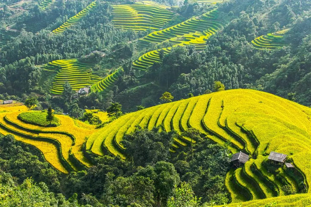
- September: Ha Giang takes on a golden appearance in September as the terraced fields reach the ripe rice season. Along the route to Ma Pi Leng Pass, visitors will observe these golden fields interspersed among the forests and rocky terrain.
- October and November: These months are characterized by the blooming of buckwheat flowers. Their delicate petals, initially pale pink, deepen in color towards the end of the season, offering a sense of tranquility. The expansive fields of these flowers contribute to a peaceful atmosphere.
- December: As colder weather arrives, canola flowers begin to bloom, gradually covering the rocky plateaus with their bright yellow. This transforms the winter landscape of Ha Giang, making it less stark than some might expect.
The Nho Que River and Local Meanings
The name "Ma Pi Leng" originates from the H'Mong language, translating to "bridge of a horse's nose," a term that describes the challenging topography of the pass, suggesting even horses would struggle for breath on its slopes. Despite its reputation for difficulty, Ma Pi Leng remains a sought-after destination for many travelers, drawn by the expansive views that inspire and motivate them to complete the journey.
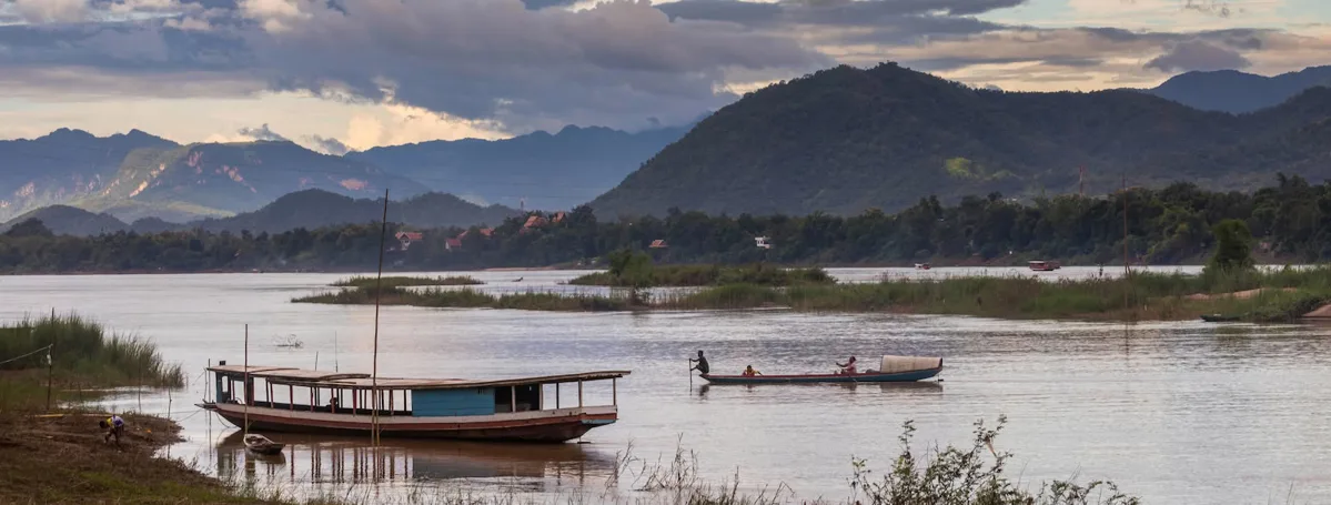
Along the route, visitors will notice the distinctive "cat-ear" rocky mountains, with sharp peaks that seem to pierce the sky. These mountains vary in appearance, some appearing grey and weathered, while others are covered in green vegetation, each offering a different visual experience. From the summit of Ma Pi Leng Pass, the Nho Que River is visible, flowing gently through the mountains below. This river originates from Nghiem Son Mountain, approximately 1,500 meters high, in China's Yunnan Province. It then flows in a northwest-to-southeast direction through Dong Van and Meo Vac Districts before merging with the Gam River in Cao Bang Province. The river contributes a softer, more poetic element to the mountainous scenery, enhancing its appeal to observers.
Standing amidst this natural setting, travelers often feel fortunate to witness such a landscape firsthand. Ma Pi Leng Pass is widely regarded as a symbol of pride for Ha Giang. Reaching this peaceful highland area typically requires several hours. As a local saying suggests, "My country still holds many wonders, there's no need to seek them abroad." A trip to Ha Giang offers an opportunity to explore this region and experience Ma Pi Leng Pass.
Frequently Asked Questions
What is the best time of year to visit Ma Pi Leng Pass?
The ideal time to visit Ma Pi Leng Pass depends on what you wish to experience. January to March offers blooming flowers and spring festivals. April is known for the Khau Vai love market. May features the pouring water season in terraced fields. September showcases golden rice fields, while October and November are best for seeing buckwheat flowers. December brings yellow canola blossoms.
What are the primary modes of transportation to Ma Pi Leng Pass?
Travelers can reach Ma Pi Leng Pass from Hanoi by bus, motorbike, or private vehicle. Motorbiking is popular for adventurous individuals, but requires good driving skills and vehicle maintenance. Buses take you to Ha Giang City, from where you can arrange further transport. Overnight rail journeys in Vietnam are another option for long-distance travel to nearby regions, offering a different perspective on Vietnamese landscapes.
What is the historical significance of Ma Pi Leng Pass?
Ma Pi Leng Pass is part of the "Happiness Road," a 200-kilometer route built by tens of thousands of volunteers from 1959 to 1965. The pass section itself took 11 months to complete using only basic tools. This construction is a testament to human determination and is sometimes referred to as the "Pyramid of the Meo people."
Are there any specific safety precautions for driving on the pass?
Yes, the roads on Ma Pi Leng Pass are known for being steep and winding. It is crucial to have confident driving skills and ensure your vehicle is in good condition. Carrying extra fuel and a repair kit is recommended. During the rainy season (June to August), roads can become particularly slippery, requiring increased caution.
What natural features can be observed from Ma Pi Leng Pass?
From Ma Pi Leng Pass, visitors can observe the dramatic "cat-ear" rocky mountains, expansive green hills, and the turquoise Nho Que River flowing below. The surrounding area is part of the Dong Van Karst Plateau Geopark, offering unique geological formations and terraced fields, especially striking during the pouring water or ripe rice seasons.