The Ha Giang Loop presents an exceptional multi-day road trip opportunity through northern Vietnam's mountainous terrain. This renowned route guides travelers through dramatic canyons and elevated mountain passes, offering a comprehensive experience of the region's unique geography. For those seeking an open-road adventure, preparing for this journey involves understanding its daily segments and practical considerations.
Planning Your Ha Giang Loop Adventure
The Ha Giang Loop is typically undertaken over four days, providing sufficient time to appreciate the changing landscapes and local culture. This route primarily follows two main roads: National Highway 4C (QL4C) leading northeast from Hà Giang City to Bảo Lâm, and National Highway 34 (QL34) guiding travelers southwest back to Hà Giang. Travelers should prepare for varying road conditions and limited amenities in remote areas.
Before setting out, it is advisable to secure sufficient cash, as automated teller machines are not widely available once outside of Hà Giang City. Planning for accommodation is also important; popular guesthouses and homestays, particularly those offering unique local character, can fill up quickly, especially during peak travel seasons. Consulting with local travel agencies for itinerary suggestions or booking specific stays can be beneficial.
A Four-Day Itinerary for the Ha Giang Loop
This detailed itinerary outlines a common four-day progression through the Ha Giang Loop, highlighting key points of interest and daily routes.
Day 1: From Hà Giang City to Yên Minh
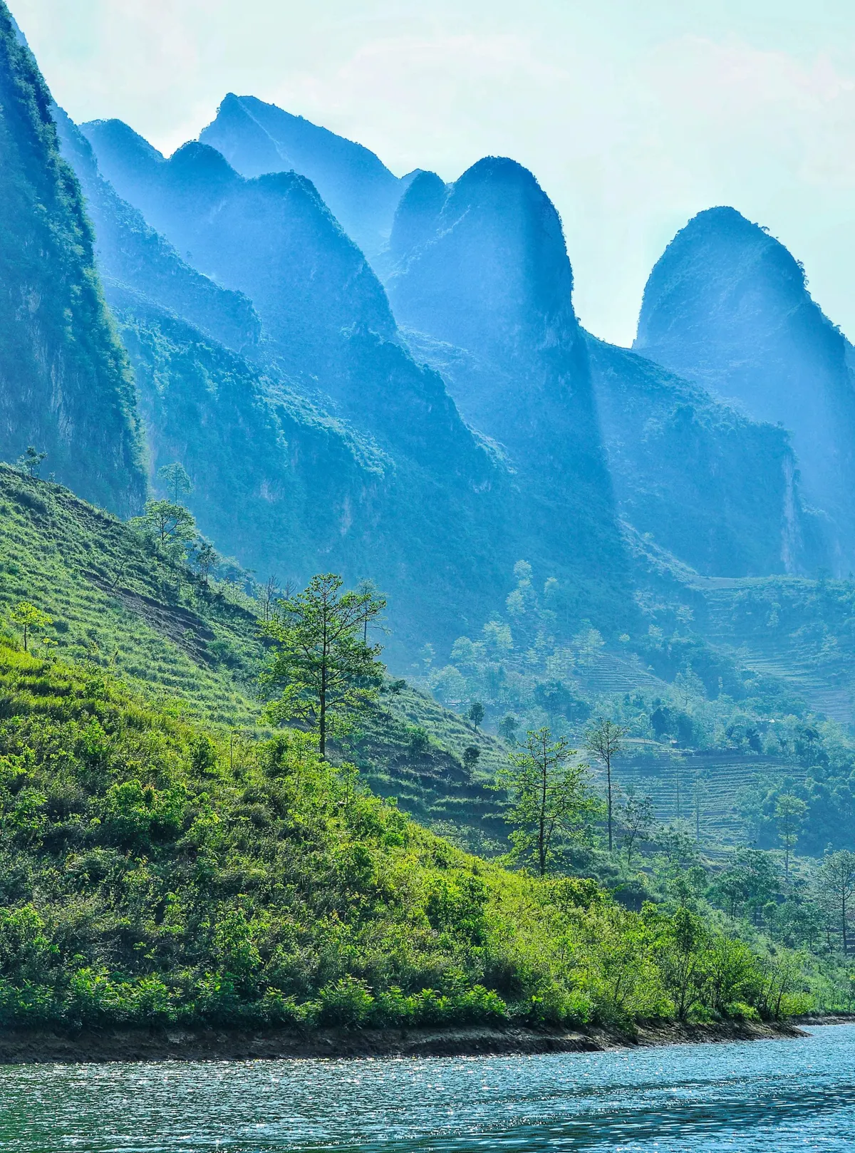
The journey commences in Hà Giang City. An early morning meal is recommended before heading north on QL4C. The initial segment of the route quickly transitions into a landscape dominated by limestone mountains, cloaked in dense jungle vegetation. Travelers soon enter the Dong Van Karst Plateau, recognized as a UNESCO Global Geopark. A significant point on this part of the trip is Heaven’s Gate Pass, which provides initial expansive views alongside challenging turns. Descending from Heaven’s Gate Pass, the route leads to Tam Sơn, a settlement distinguished by its surrounding forested hills, suitable for a midday meal. Establishments here and roadside vendors typically offer Northern Vietnamese dishes. Refreshments, including Vietnamese coffee, are readily available.
In the afternoon, continue along QL4C towards Yên Minh. The road follows the Mien River for a segment before ascending through a tall canyon. The path then traverses karst plateaus and mountain passes, eventually reaching Yên Minh, where travelers can find local lodging for the night.
Day 2: Towards the Vietnamese Border and Đồng Văn
Begin the second day with a hot bowl of pho for breakfast before you set off for Dong Van, taking the QL4C northeast. The steep road quickly rises above the tree line, revealing an otherworldly landscape of eroded limestone karsts with incredible views at every turn. Dốc Chín Khoanh (Nine Turn Pass) is a recommended stop to observe the series of curved roads descending into the valley below. The Sà Phìn area serves as a suitable location for food and to refuel vehicles.
An optional three-hour diversion leads to the Lũng Cú Flag Tower. This site provides panoramic views extending over the border into China, which many visitors consider worthwhile. Returning to QL4C, the journey to Đồng Văn continues with many scenic vistas. Upon arrival in Đồng Văn, travelers can visit a local market, either in the evening or early morning, to observe the activities of various ethnic minority groups. It is advisable to confirm market schedules with local hosts in Đồng Văn, as these events offer a significant cultural experience. For those interested in the culinary traditions of the area, exploring Ha Giang's distinctive cuisine can enhance the market visit.
Day 3: Đồng Văn, Mã Pí Lèng Pass, and Bảo Lâm
The third day features what many consider the most impressive section of the route. From Đồng Văn, the road winds through immense peaks and canyons, with the valley floor dropping considerably below, leading towards Mã Pí Lèng Pass. The abundance of scenic viewpoints often encourages frequent stops for photography. Mèo Vạc is approximately 24 kilometers from Đồng Văn; however, reaching it can take a substantial part of the morning due to stops for appreciating the wide-ranging views. Mèo Vạc itself is a settlement with unique character and various options for lunch.
For a brief diversion in the afternoon, turn left off QL4C at the base of Mã Pí Lèng Pass onto side road 193A. This short route offers a closer perspective of the Nho Quế River winding below. The day concludes in Bảo Lâm, a small settlement known for its welcoming residents. This remote setting provides an opportunity for relaxation before the return journey to Hà Giang.
Day 4: Return to Hà Giang City
The final day begins with a simple breakfast in Bảo Lâm, followed by stocking up on any necessary supplies for the trip back. From Bảo Lâm, take QL34 southwest towards Hà Giang. This road largely follows the Gâm River, providing a pleasant drive along the valley floor. While there are still twists and some passes, this segment is generally less demanding than previous days. A stop in Bắc Mê offers an opportunity for a meal at one of the local food stalls. Towns become less frequent as travelers approach Hà Giang City.
Upon returning to Hà Giang City, travelers can enjoy modern conveniences after completing the extensive journey. For those seeking more than just the main road, experiences in Ha Giang extend to authentic local encounters and less-explored areas.
Essential Travel Advice for the Ha Giang Loop
Undertaking the Ha Giang Loop requires careful preparation to ensure a safe and enjoyable trip. The northernmost region of Vietnam, while stunning, has limited infrastructure outside of major towns.
What to Expect
Travelers should be aware that resources become scarce once outside Hà Giang City. Access to cash is particularly important, as ATMs are not common in the smaller towns and villages along the loop. It is prudent to carry enough cash for the entire duration of the trip.
Getting to Hà Giang
Hà Giang City serves as the starting point for the loop. Regular daytime and overnight bus services operate from My Dinh bus station in Hanoi to Hà Giang. Alternatively, private transfers and organized tours can be arranged online or through various tour operators in the capital. For those considering Northern Vietnam day trips, reaching Ha Giang can be the first step in a longer regional exploration.
Motorbike Rental and Road Conditions
Motorbikes are widely available for rent in Hà Giang City. For maintenance and service, both Honda and Kawasaki Service Centres are present in town. The roads along the Ha Giang Loop are generally well-maintained. However, travelers should remain vigilant for unexpected obstacles or ongoing construction work. Safety considerations include approaching curves with caution and limiting driving to daylight hours, as stopping after dark is recommended due to reduced visibility and potential hazards. Vietnam's top outdoor activities often involve navigating diverse terrains, and the Ha Giang Loop is a prime example.
Exploring Local Culture and Cuisine Along the Route
The Ha Giang Loop offers more than just scenic drives; it provides opportunities to engage with local culture and sample regional flavors.
Local Markets
Throughout the journey, particularly in towns like Đồng Văn, local markets serve as important community hubs. These markets are places where various ethnic minority groups conduct their daily business, offering a glimpse into their traditions and livelihoods. Visiting a market can be a culturally enriching experience, allowing travelers to observe local interactions and traditional goods. It is advisable to inquire about specific market dates and times upon arrival in a town, as schedules can vary.
Regional Cuisine
The northern region of Vietnam, especially Ha Giang Province, boasts a distinctive culinary heritage. Along the loop, travelers can find local restaurants and roadside stalls serving classic Northern Vietnamese dishes. These often feature fresh, locally sourced ingredients and unique preparation methods. From hearty bowls of pho for breakfast to other regional specialties, food is an integral part of the travel experience here.
Frequently Asked Questions
How long does it take to complete the Ha Giang Loop?
The Ha Giang Loop is typically completed over four days, allowing travelers to experience the main attractions and scenic routes at a comfortable pace. While it is possible to do it in fewer days, four days is generally recommended for a comprehensive experience.
What is the best way to get to Ha Giang City?
Travelers usually reach Ha Giang City by bus from Hanoi. Both daytime and overnight services are available from My Dinh bus station. Private transfers and guided tours starting from Hanoi are also options for reaching the city.
Are ATMs available along the Ha Giang Loop?
ATMs are scarce once outside of Hà Giang City. It is strongly advised to carry sufficient cash for the entire duration of your trip, including fuel, food, and accommodation expenses.
What are the road conditions like on the Ha Giang Loop?
The roads are generally in good condition, but travelers should be prepared for winding mountain passes, steep inclines, and potential obstacles like construction or debris. Driving during daylight hours and exercising caution on curves are important safety practices.
Is it necessary to book accommodation in advance?
During peak travel seasons, popular accommodations, especially homestays and guesthouses with local character, can book up quickly. It is recommended to contact local travel companies or book in advance, particularly if traveling during busy periods.