
Vietnam's landscape is profoundly shaped by its numerous rivers, which serve as lifelines for agriculture, commerce, and cultural traditions across the nation. With a dense network comprising 2,360 rivers, each extending over 10 kilometers, and a combined length of 41,900 kilometers, these waterways are deeply woven into the country's identity. They have witnessed centuries of Vietnamese history and remain central to daily activities, folk culture, and travel experiences.
These significant rivers provide a unique lens through which to understand Vietnam's heritage, from ancient agricultural practices to modern urban development. Exploring these water bodies offers travelers opportunities to engage with local communities, observe traditional livelihoods, and appreciate the diverse natural environments found throughout the country.
Vietnam's Extensive River Network
Vietnam possesses a remarkable hydrological system, with thousands of rivers flowing from north to south. This network includes 23 cross-border rivers and 392 inter-provincial rivers, highlighting the interconnectedness of the nation's geography. The term for river in Vietnamese is "Sông," as seen in names like Sông Sài Gòn (Saigon River) or Sông Thái Bình (Thai Binh River).
Among these, the Đồng Nai River stands as Vietnam's longest inland river, stretching 586 kilometers. The widest river is the Hậu River, a tributary of the Mekong, measuring 4,000 meters across between Trà Vinh and Sóc Trăng provinces. This extensive system underscores the country's long-standing connection to water-based civilizations, particularly wet rice cultivation.
Iconic Rivers of Northern Vietnam
Nho Quế River (Sông Nho Quế)
Located in Hà Giang province, the Nho Quế River is celebrated for its dramatic scenery. Originating from Nghiêm Sơn Mountain in China at an elevation of 1,500 meters, its upper course forms part of the border between Vietnam and China, creating waterfalls as it descends through rugged terrain. Upon entering Vietnam, the river carves its way through the Tu Sản Canyon and flows alongside the Mã Pí Lèng Pass before reaching Mèo Vạc District, approximately 15 kilometers from Lũng Cú Town. Further downstream in Cao Bằng, it branches before merging with the Gâm River at the Nà Mát falls.
Many adventure enthusiasts seek to traverse the Mã Pí Lèng Pass, pausing at its viewpoint to gaze down at the Nho Quế River. From this vantage point, the river appears as a slender, turquoise ribbon, often partially obscured by mist, creating a serene natural vista. Visitors can also take boat rides along the river's edge, following paths carved by local inhabitants, to observe indigenous villages and the deep ravine.
Red River (Sông Hồng)
The Red River, one of northern Vietnam's most substantial waterways, holds immense importance for the region's inhabitants. Its journey begins in China's Yunnan province, flowing southeast through deep gorges before entering Vietnam at Lào Cai. It then traverses nine provinces, eventually emptying into the Gulf of Tonkin through a vast delta. The river derives its name from the high concentration of iron oxide in its silt-laden waters, which imparts a reddish hue throughout the year.
As it passes through Hà Nội, the Red River carries nutrient-rich sediment to its delta, a region where wet rice cultivation has been practiced for centuries. The alluvial deposits contribute to the fertile soil, supporting not only rice but also crops such as wheat, beans, rapeseed, and corn. Due to annual flooding, local communities have developed an intricate system of dikes and canals to safeguard their land and homes. Historically, the seasonal demand for a large workforce for rice replanting led farmers to pursue other non-agricultural activities during fallow periods, giving rise to specialized craft villages. These villages, known for producing items like conical hats, ceramics, and pottery, continue this tradition today, particularly in rural areas surrounding Hà Nội, and are popular tourist destinations. For those interested in acquiring traditional crafts, these villages offer unique opportunities.
Hà Nội features several bridges spanning the Red River, with the Nhật Tân and Long Biên bridges being particularly notable. The Nhật Tân Bridge, a 5-kilometer suspension bridge inaugurated in 2015, connects Nội Bài International Airport with central Hà Nội. Its five towers symbolize the city's ancient gates, establishing it as a modern landmark. The historic Long Biên Bridge, constructed by the French company Daydé & Pille between 1898 and 1902, is more than just a crossing; it serves as a historical emblem of Hà Nội. Despite the emergence of newer structures, this two-century-old bridge remains a favored location for locals to experience the river's tranquility and appreciate its architectural heritage.
Central Vietnam's Waterways: History and Scenery
Ngô Đồng River (Sông Ngô Đồng)
The Ngô Đồng River, a smaller waterway in Ninh Hải Commune, Hoa Lư District, Ninh Bình, is a focal point for visitors to Tam Cốc. Flowing from the low-lying areas within the limestone mountains of the Tràng An Landscape Complex World Heritage site, it meanders through cliffs and rice paddies. The river's name, translating to "Corn Field," reflects the appearance of the surrounding rice fields during the harvest season in late May and early June, when they turn golden yellow, seemingly coloring the river itself. On sunny days, the water reflects the sunlight, enhancing the visual appeal of the landscape.
To fully appreciate the river's charm, visitors often ascend 486 stone steps to the peak of nearby Múa Cave. From this elevated position, a comprehensive view unfolds, showcasing rowing boats gliding along the river, fragrant golden rice fields on both banks, and towering limestone formations. A traditional paddle-boat journey along the Ngô Đồng River is a primary activity in Tam Cốc, often referred to as "Ha Long Bay on land." These two-hour trips typically pass through three caves: Cá, Hai, and Ba. Local oarsmen and women often share stories of river life, enriching the travel experience.
Bến Hải River (Sông Bến Hải)
While not widely known for its natural beauty, the Bến Hải River in Central Vietnam holds profound historical significance. During the Vietnamese-American War, it served as the demarcation line, along the 17th parallel, dividing North and South Vietnam following the 1954 Geneva Conference. A five-kilometer buffer zone on either side formed the Demilitarized Zone (DMZ), which physically separated families and communities for 21 years.
The Bến Hải River originates from Đồng Chân Mountain in the Trường Sơn mountain range, flowing eastward along the 17th parallel before emptying into the sea at Cửa Tùng. The Hiền Lương Bridge, situated over the Bến Hải River in Vĩnh Linh District, Quảng Trị Province, became an enduring symbol of the country's aspiration for reunification. Initially a wooden pedestrian bridge built by French colonialists in 1952, it was destroyed during the war in 1967 and later restored, reopening on May 18, 2003. Both banks of the river feature relic sites recognized as special national historical monuments, commemorating the struggles endured until national reunification in 1975.
Sơn River (Sông Sơn)
The Sơn River in Quảng Bình Province is well-known as the waterway leading to Phong Nha Cave, a prominent attraction. This 35-kilometer tributary of the Gianh River flows entirely within Bố Trạch District. Its journey begins at the mouth of Phong Nha Cave, with an upstream section of 7,729 meters flowing underground through the limestone mountains of western Quảng Bình, within the Phong Nha-Kẻ Bàng Heritage Forest. Beyond its role as an access point, the river is noted for its appealing appearance, with green waters that mirror the surrounding Kẻ Bàng limestone formations. Local legends associate the river's name with a tale of devoted lovers, whose tragic story is said to symbolize enduring affection.
Perfume River (Sông Hương)
The Perfume River, situated within Huế Imperial City, is one of Central Vietnam's most celebrated waterways. Spanning approximately 80 kilometers, it flows from the Trường Sơn Mountain range, through the heart of Huế City, and past numerous villages such as Kim Long, Nguyệt Biều, and Vỹ Dạ. Its name, established over a century ago, is attributed to the scent of flowers from upriver orchards that would fall into the water during autumn, imparting a fragrant aroma. Historically, the river served as a natural defensive barrier for the ancient capital, from the reign of King Kim Long (1630–1687) to King Phú Xuân (1687–1712).
The Perfume River is deeply integrated into Huế's cultural life, hosting traditional activities like Ca Huế (Hue traditional folk songs) and boat racing. It has also inspired countless artists, poets, and musicians. Alongside Ngự Bình Mountain, the river is considered an emblem of Huế's enduring beauty and culture. A dragon boat trip along the Perfume River is a popular activity, offering views of riverine life and significant landmarks such as Thiên Mụ Pagoda, Hòn Chén Temple, and royal tombs like those of Tự Đức and Minh Mạng. The riverfront becomes particularly lively in the evenings, with the Tràng Tiền Bridge (Cầu Trường Tiền) illuminated by colorful LED lights. Evening dinner cruises provide an opportunity to enjoy the sunset, listen to traditional Huế folk music, and sample local specialties, often concluding with the release of paper lotus lanterns onto the water. When planning a visit to Hue, understanding local banking options can be helpful.
Southern Vietnam's Dynamic Rivers
Hàn River (Sông Hàn)
The Hàn River is the primary waterway flowing through the center of Đà Nẵng City. While the river itself is notable, it is most recognized for the impressive bridges that span it and the activities along its banks. The river originates from the confluence of three districts—Cẩm Lệ, Hải Châu, and Ngũ Hành Sơn—and flows approximately 7 kilometers before reaching Đà Nẵng Bay. The riverfront is a hub for events, including an annual international fireworks competition that draws visitors globally. Nine bridges cross the Hàn River in Đà Nẵng, ranging from the fire-breathing Dragon Bridge (Cầu Rồng) to the unique Rotating Hàn River Bridge (Cầu Quay). The Dragon Bridge performs a display of fire and water on Saturday and Sunday evenings, which is a popular spectacle. Travelers to Đà Nẵng may also find it useful to understand the local financial services available.
To experience the Hàn River and its bridges, visitors can opt for a river cruise for a distinct perspective. Alternatively, high-rise buildings along the river, such as hotels or plazas, offer elevated viewpoints. Public spaces like squares, parks, or nearby cafes also provide pleasant settings to observe the riverine landscape.
Hoài River (Sông Hoài)
The Hoài River, a tributary of the Thu Bồn River, flows through the ancient town of Hội An, approximately 30 kilometers from Đà Nẵng City. This smaller river contributes significantly to Hội An's serene and poetic atmosphere, becoming an enduring symbol for both residents and visitors. Local residents often operate rowing boats to transport tourists, offering a 30-minute journey that provides a different perspective of the ancient town. During these trips, boat operators may share insights into their daily lives, local culture, and the town's history. For those visiting Hội An, managing finances is a common consideration.
Without machinery, the rowing boats allow passengers to hear the gentle sound of paddles in the water, contributing to a peaceful ambiance. In the evenings, the river transforms into a luminous scene with colorful lanterns adorning nearby streets and boats. Traditional folk songs from the Quảng region are sometimes performed by local singers on wooden boats, creating a relaxing experience. A special tradition occurs on the 14th night of every lunar month, when the town dims electric lights and displays decorative lanterns outside homes, a practice observed for over 300 years, enhancing the town's moonlit charm.
Sêrêpôk River (Sông Sêrêpôk)
Situated west of the Trường Sơn mountain ranges, the Sêrêpôk River is 406 kilometers long and represents the largest river system in Đắk Lắk Province. Known by its Khmer name "Tonle Xrepok," it is an important tributary of the Mekong River, originating in Cambodia before entering Vietnam. A local legend explains the confluence of the Krông Knô and Krông Ana streams, which form the Sêrêpôk. The story tells of two lovers from rival families who, unable to be together, tragically ended their lives in the river. Following their deaths, the river's waters are said to have divided into two branches, named after the couple, and their subsequent merging creates aggressive, churning rapids, symbolizing their enduring, powerful love.
The Sêrêpôk River is also recognized for its numerous waterfalls in the Central Highlands, including Trinh Nữ, Dray Sáp, Dray Nur, Gia Long, and Bảy Nhánh waterfalls. These sites attract those interested in exploring wild natural landscapes. Accessing the river's birthplace typically involves traveling from Buôn Ma Thuột city in Đắk Lắk Province to Buôn Trấp Town in Krông Ana District. From there, the journey continues on unpaved roads and farm tracks, eventually requiring a boat trip to reach the confluence where the muddy Krông Ana stream meets the clear Krông Knô line. Fed by many smaller rivers and streams within expansive forests, the Sêrêpôk offers an appealing experience for adventurous travelers.
Mekong River (Sông Mê Kông)
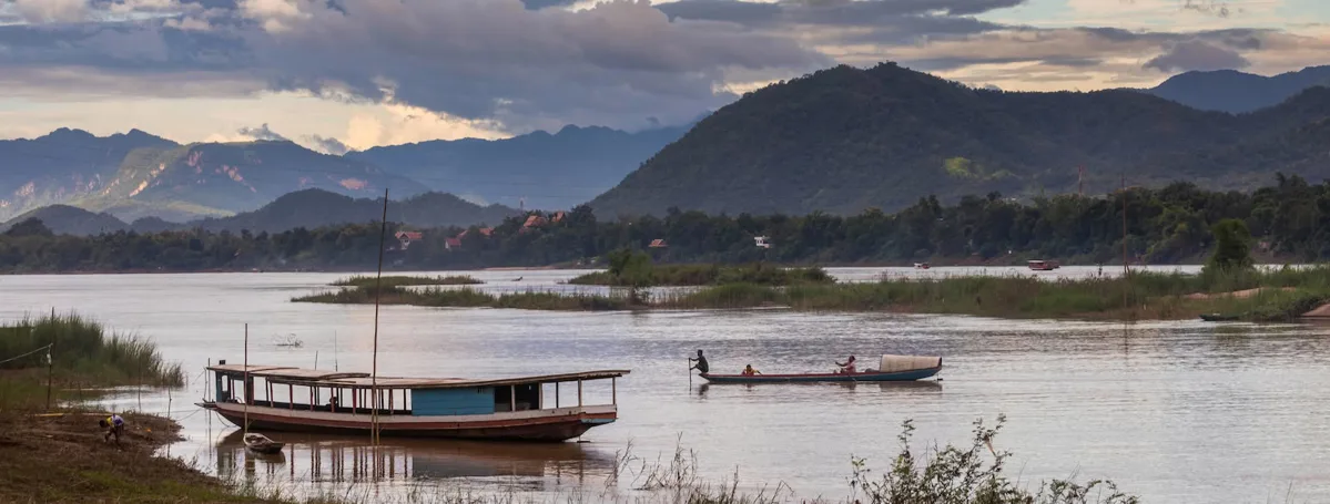
The Mekong River is a colossal waterway, ranking as the twelfth largest river globally and the seventh largest in Asia. Its source is near Tibet in China, from where it flows through China's Yunnan Province, Myanmar, Laos, Thailand, and Cambodia, before finally entering Southern Vietnam. In Vietnam, the downstream section of the Mekong divides into nine estuaries (though currently only seven are active), earning it the local name "Sông Cửu Long," or "Nine-Dragon River." The vast amount of sediment deposited annually by the Mekong creates the fertile Mekong Delta, which is Vietnam's largest agricultural region.
Beyond its agricultural significance, the Mekong is a popular destination for travelers interested in experiencing riverine life. River cruises are a common way for visitors to explore the Mekong Delta, offering glimpses into authentic riverside communities and traditional workshops. The region is particularly famous for its unique floating markets, such as Cái Răng in Cần Thơ City, where a wide array of goods are traded from rustic bamboo boats. Other notable experiences in the Mekong Delta include visiting the Trà Sư Cajuput Forest in An Giang and the U Minh Forest in Cà Mau. Various tour operators offer day trips to the Mekong River from Hồ Chí Minh City, often including destinations like Bến Tre, Cái Bè, and Mỹ Tho, catering to those with limited time or seeking a brief introduction to the region.
Notable Riverine Destinations and Activities
| River Name | Location | Primary Associated Activity or Feature |
|---|---|---|
| Nho Quế River | Hà Giang | Scenic boat trips, views from Mã Pí Lèng Pass |
| Red River | Northern Vietnam, Hà Nội | Historical bridges (Long Biên, Nhật Tân), craft villages |
| Ngô Đồng River | Ninh Bình (Tam Cốc) | Sampan rides through rice fields and caves |
| Bến Hải River | Quảng Trị | Historical DMZ boundary, Hiền Lương Bridge |
| Sơn River | Quảng Bình | Boat access to Phong Nha Cave |
| Perfume River | Huế | Dragon boat cruises, traditional folk music evenings |
| Hàn River | Đà Nẵng | Illuminated bridges (Dragon Bridge), annual fireworks |
| Hoài River | Hội An | Traditional rowing boat trips, lantern festivals |
| Sêrêpôk River | Đắk Lắk (Central Highlands) | Waterfalls (Dray Nur, Dray Sáp), unique river confluence |
| Mekong River | Southern Vietnam (Mekong Delta) | Floating markets (Cái Răng), agricultural tours |
Note: Specific addresses, phone numbers, operating hours, and prices for these natural sites and their associated general activities were not provided in the source material. Visitors are advised to verify current details with local tour operators or information centers.
Frequently Asked Questions
How many rivers are there in Vietnam?
Vietnam is home to an extensive river system, with approximately 2,360 rivers that are each longer than 10 kilometers. This network includes 23 cross-border rivers and 392 rivers that flow between provinces.
What is Vietnam's longest inland river?
The Đồng Nai River holds the distinction of being Vietnam's longest inland river, stretching for 586 kilometers. It plays a crucial role in the hydrology and economy of the southern regions.
Which is the widest river in Vietnam?
The Hậu River, a significant tributary of the Mekong River, is considered the widest river in Vietnam. It measures approximately 4,000 meters across at its broadest point, situated between Trà Vinh and Sóc Trăng provinces.
What does the term "Sông" mean in Vietnamese river names?
In Vietnamese, "Sông" directly translates to "river." It is commonly used as a prefix in the names of rivers, such as Sông Sài Gòn (Saigon River) or Sông Hồng (Red River), to denote a waterway.
Which Vietnamese rivers are known for their historical significance?
Several rivers in Vietnam are deeply tied to the nation's history. The Bến Hải River famously served as the demarcation line during the Vietnamese-American War. The Bạch Đằng River is renowned for three historic victories where Vietnamese forces defeated Chinese invaders using legendary wooden pile traps between 938 and 1288. The Red River also holds historical importance for the development of wet rice civilization and craft traditions in northern Vietnam.