Understanding Vietnam's geographical layout is fundamental for effective travel planning, as the country's elongated shape creates significant regional variations. From its northern borders to its southern tip, distinct climates, cultural practices, and culinary traditions emerge, influencing the experiences available to visitors. By recognizing these regional characteristics, travelers can better tailor their itineraries to match their interests and the seasonal conditions.
Vietnam's Unique Geographical Profile
Vietnam is a nation in Southeast Asia, characterized by its long, narrow shape. Its land area is roughly comparable to the state of California. The country boasts an extensive coastline stretching approximately 3,260 kilometers (about 2,030 miles), offering numerous coastal attractions. As of 2021, the population of Vietnam was nearly 100 million, comprising 54 distinct ethnic groups, each contributing to the nation's rich cultural fabric.
The country's topography varies considerably, from the mountainous northern regions to the fertile deltas in the south. This geographical diversity plays a crucial role in defining the local environments and the types of activities and sights available in different areas. Recognizing these physical attributes helps in appreciating the varied experiences Vietnam offers.
Distinct Regions for Exploration
Vietnam is broadly divided into three primary geographical and cultural divisions: the North, Central, and South. Each section presents unique characteristics that influence travel experiences.
Northern Vietnam (Miền Bắc)
The northern part of Vietnam, known as Miền Bắc, extends from the country's northernmost point at Lung Cu Flag Tower, located in Lang Son province, southward to the 17th parallel. This region is historically significant, marked by sites such as the Hien Luong Bridge crossing the Ben Hai River, which once served as a demarcation line. Northern Vietnam is characterized by its cooler climate and mountainous terrain, offering experiences distinct from the warmer southern areas.
Central Vietnam (Miền Trung)
Central Vietnam, or Miền Trung, represents the narrowest section of the country, with some areas measuring only about 50 kilometers wide from the Laotian border to the sea. This region includes 19 provinces and covers an area exceeding 150,000 square kilometers, with a population of over 27 million people. It is known for its historical cities and coastal stretches, often experiencing more extreme weather conditions than other parts of the country.
Southern Vietnam (Miền Nam)
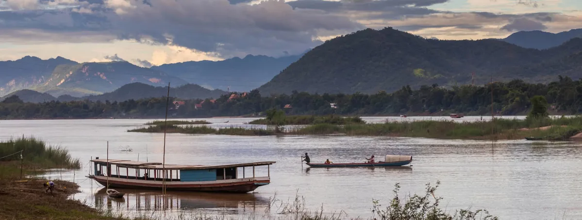
Southern Vietnam, or Miền Nam, encompasses 17 provinces and extends to the country's farthest southern point at Ca Mau. Major urban centers in this region include Ho Chi Minh City and Can Tho. This area is typically warmer and is characterized by its extensive river systems, particularly the Mekong Delta, which supports a rich agricultural landscape and unique water-based lifestyles.
Key Destinations Across Vietnam
Vietnam offers a wide array of destinations catering to various interests, from historical sites and cultural experiences to natural landscapes and beach resorts. Here is a selection of popular places organized by region:
Northern Vietnam Destinations
- Hanoi: The capital city, known for its ancient temples, colonial architecture, and vibrant street life.
- Sapa: A mountainous town renowned for its terraced rice fields and ethnic minority cultures. Visitors often ascend Mount Fansipan for panoramic views.
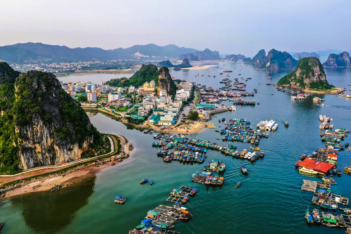
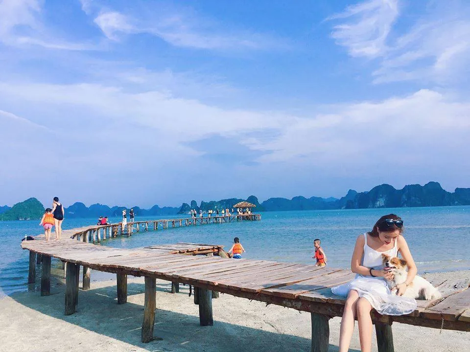
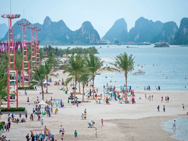
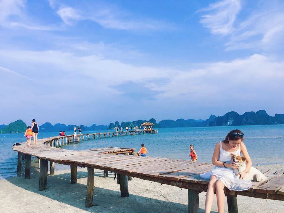
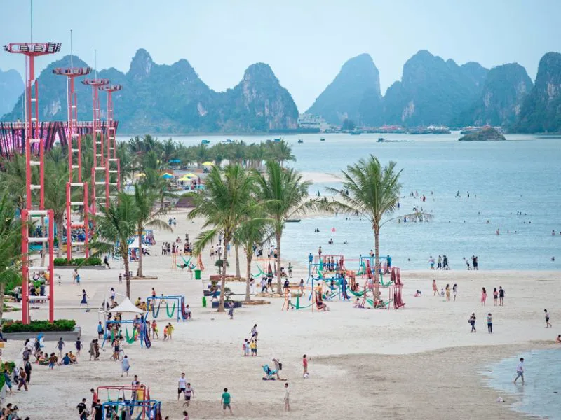
- Halong Bay: A UNESCO World Heritage site famous for its limestone karsts and islets. Many travelers seek out Halong Bay's best beaches for relaxation.
- Mai Chau: A peaceful valley offering insight into rural Vietnamese life and traditional stilt houses.
- Ninh Binh: Often called 'Halong Bay on land,' with scenic rivers, limestone formations, and ancient temples.
- Moc Chau: Known for its tea plantations and plum blossoms.
- Dien Bien Phu: A site of significant historical importance related to the First Indochina War.
- Hoa Binh: Home to diverse ethnic communities and scenic reservoirs.
- Ha Giang: A northern province celebrated for its dramatic mountain passes and remote landscapes.
- Cat Ba Island: Part of the Halong Bay archipelago, offering beaches, caves, and national park access.
- Cao Bang: Features impressive waterfalls and historical caves.
- Hai Phong: A major port city with colonial architecture and local cuisine.
- Ba Be Lake: Vietnam's largest natural lake, surrounded by limestone mountains and forest.
- Lang Son: A border city with historical forts and bustling markets.
- Bac Kan: Known for its natural beauty, including Ba Be Lake.
- Lai Chau: A mountainous province with diverse ethnic groups.
- Lan Ha Bay: Adjacent to Halong Bay, offering similar scenery with a quieter atmosphere.
- Son La: Features a historic prison and tea plantations.
Central Vietnam Destinations
- Hoi An: An ancient town recognized for its well-preserved architecture, tailor shops, and lantern-lit streets.
- Hue: The former imperial capital, home to the Citadel, royal tombs, and pagodas.
- DMZ (Demilitarized Zone): Sites of historical significance from the Vietnam War.
- Da Nang: A coastal city with modern infrastructure, bridges, and beaches.
- Nha Trang: A popular beach resort city known for its clear waters and diving opportunities.
- Phong Nha-Ke Bang: A national park famous for its vast cave systems.
- Buon Ma Thuot: The capital of Dak Lak province, known for its coffee plantations.
- Dak Lak: A region in the Central Highlands, offering insights into local ethnic cultures and elephant conservation.
- Phu Yen: A coastal province with unspoiled beaches and unique rock formations.
- Huong Khe: A district in Ha Tinh province, known for its natural beauty.
- Vinh: A city in Nghe An province, with historical sites and a developing urban center.
- Kon Tum: A Central Highlands city with a notable wooden church and ethnic minority villages.
- Da Lat: A hill station known for its temperate climate, French colonial villas, and flower gardens.
- Quang Binh: Home to Phong Nha-Ke Bang National Park.
- Plei Ku: A city in the Central Highlands, known for its natural landscapes.
- Phan Rang: A coastal city in Ninh Thuan province, known for its Cham culture and vineyards.
Southern Vietnam Destinations
- Ho Chi Minh City: The largest city, a bustling economic hub with historical landmarks, museums, and modern attractions.
- Ben Tre: Part of the Mekong Delta, famous for its coconut production and river tours.
- Con Dao Island: An archipelago known for its pristine beaches, coral reefs, and historical prison sites.
- My Tho: A gateway city to the Mekong Delta, offering boat trips and local markets.
- Can Tho: The largest city in the Mekong Delta, famous for its floating markets.
- Chau Doc: A border town with Cambodia, known for its cultural diversity and Sam Mountain.
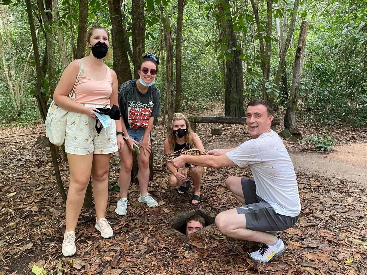
- Cu Chi & Tay Ninh: Sites of the Cu Chi Tunnels, offering insights into Vietnam War history.
- Mui Ne: A coastal town known for its sand dunes and watersports.
- Rach Gia: A port city in the Mekong Delta, serving as a gateway to Phu Quoc Island.
- Sa Dec: A charming town in the Mekong Delta, known for its flower gardens and historical connections.
- Soc Trang: A city in the Mekong Delta, recognized for its Khmer temples and cultural heritage.
- Phu Quoc: Vietnam's largest island, popular for its white-sand beaches and resorts.
- Tra Vinh: A province in the Mekong Delta with a significant Khmer population and many temples.
- Vung Tau: A coastal city near Ho Chi Minh City, popular for weekend getaways.
- Vinh Long: A Mekong Delta province known for its fruit orchards and traditional handicrafts.
Culinary and Cultural Diversity
Vietnam's extensive length also means significant variations in its culinary traditions and cultural expressions. The food, flavors, and even dish names can differ considerably from one region to another, reflecting local ingredients and historical influences.
Northern Vietnamese cooking is often described as complex, offering a rich array of tastes and a sophisticated balance of flavors, frequently incorporating the principles of Yin and Yang in its preparation. Dishes here tend to be savory and less sweet or spicy compared to other regions.
In Central Vietnam, the cuisine is typically spicier and more diverse. Restaurants, particularly in cities like Hue and Hoi An, present extensive menus with a wide selection of dishes, many of which are known for their strong, aromatic profiles and use of chili.
Southern Vietnamese food tends to be sweeter, often incorporating coconut milk and sugar. The emphasis is on fresh ingredients, with many households purchasing food daily rather than relying on refrigeration, ensuring the highest quality in their meals.
Culturally, Vietnam is home to 54 ethnic groups, each with its own distinct language, customs, and traditional attire. While all contribute to the national identity, only four of these groups possess their own written scripts, highlighting the rich linguistic diversity within the country.
Historical Context and Climate Variations
Vietnam boasts a history spanning over four millennia, with significant events shaping its identity. Hanoi, the current capital, was established more than a thousand years ago, while Saigon (now Ho Chi Minh City) was founded over three centuries ago. Traveling from north to south offers a chronological journey through the nation's historical timeline, revealing layers of its past.
The country's considerable length, with over 2,000 kilometers separating Hanoi and Ho Chi Minh City, leads to distinct climatic zones:
- Northern Vietnam: Experiences four distinct seasons: spring, summer, autumn, and winter. Winters can be cool, while summers are warm and humid.
- Central Vietnam: Often experiences amplified extremes. While summers can reach temperatures of 40°C (104°F), occasional snow has been reported in higher elevations during winter months.
- Southern Vietnam: Primarily has two main seasons: a dry season and a wet (rainy) season, with consistently warm temperatures throughout the year.
Many travelers find it appealing to begin their Vietnamese holiday in the cooler northern regions, gradually making their way south. This allows them to conclude their trip in the warmer southern areas, perhaps enjoying a sunny beach resort before their departure. For longer journeys, considering overnight rail journeys can be an efficient and scenic way to traverse the country.
Planning Your Journey Through Vietnam
When preparing for a trip to Vietnam, considering the country's geographical divisions, diverse cultural offerings, and varying climates is essential. This understanding allows for a more informed itinerary, whether your interest lies in historical exploration, culinary adventures, or relaxing on the coast. Planning around these regional differences ensures a richer and more appropriate travel experience. Remember to also consider local crafts and products as unique purchases from a trip to Vietnam.
Frequently Asked Questions
What are the main geographical regions of Vietnam?
Vietnam is typically divided into three main geographical regions: Northern Vietnam (Miền Bắc), Central Vietnam (Miền Trung), and Southern Vietnam (Miền Nam). Each region has distinct characteristics in terms of landscape, climate, and culture.
How does Vietnam's climate vary by region?
Northern Vietnam experiences four distinct seasons. Central Vietnam can have more extreme weather, including hot summers and cooler winters with occasional snow in higher elevations. Southern Vietnam generally has two main seasons: a dry season and a wet season, with consistently warm temperatures.
Are there significant differences in food across Vietnam?
Yes, Vietnamese cuisine varies significantly by region. Northern food is often complex and balanced, Central Vietnamese dishes tend to be spicier and more diverse, and Southern Vietnamese cuisine is typically sweeter and emphasizes fresh ingredients.
What is the population and ethnic diversity of Vietnam?
As of 2021, Vietnam's population was nearly 100 million, composed of 54 different ethnic groups. These groups contribute to the country's rich cultural tapestry, each with unique languages, customs, and traditional attire.
How long is Vietnam's coastline?
Vietnam has an extensive coastline that stretches approximately 3,260 kilometers (about 2,030 miles), offering numerous beaches and coastal areas for visitors to enjoy.